Emergency Riverbank Repairs Protect Fort Worth’s Twin 90-Inch Pipes
When erosion along the Trinity River exposed a 90-inch wastewater pipeline — and then a sheet pile wall temporarily protecting the pipe collapsed — a multidiscipline Freese and Nichols team applied an urgent response and innovation to avert an environmental disaster for the City of Fort Worth.
The team brought together expertise in geomorphology, structural design, wastewater systems, natural channel design, environmental permitting and emergency project management to partner with City staff and multiple construction teams on a solution.
The repairs were designed, permitted and completed in a fraction of the typical time, despite the challenges of rainy weather and the COVID-19 pandemic. The efforts prevented a sewage spill and protected the pipeline and its twin, which convey 150 MGD of wastewater to Fort Worth’s Village Creek Water Reclamation Facility.
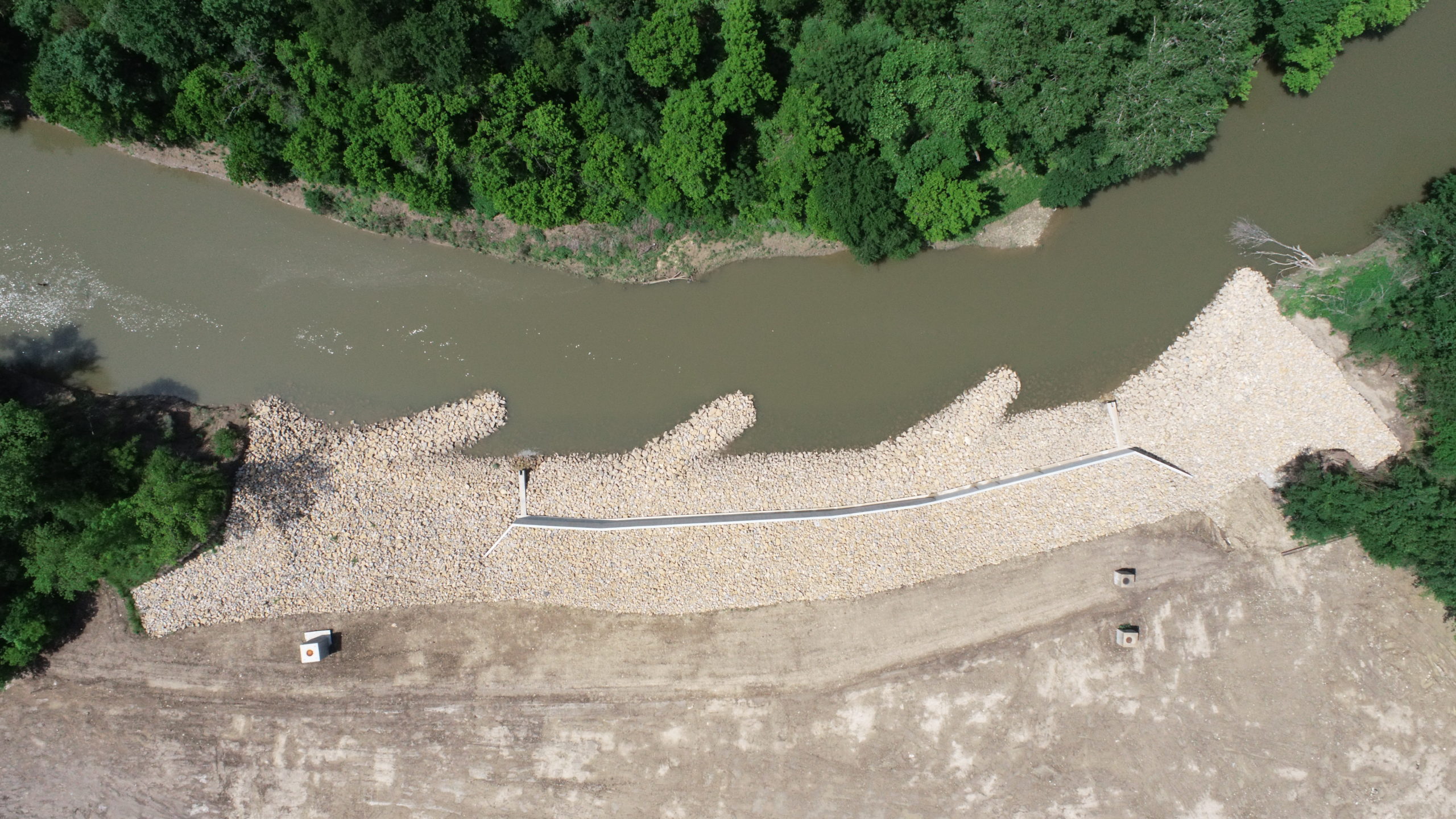
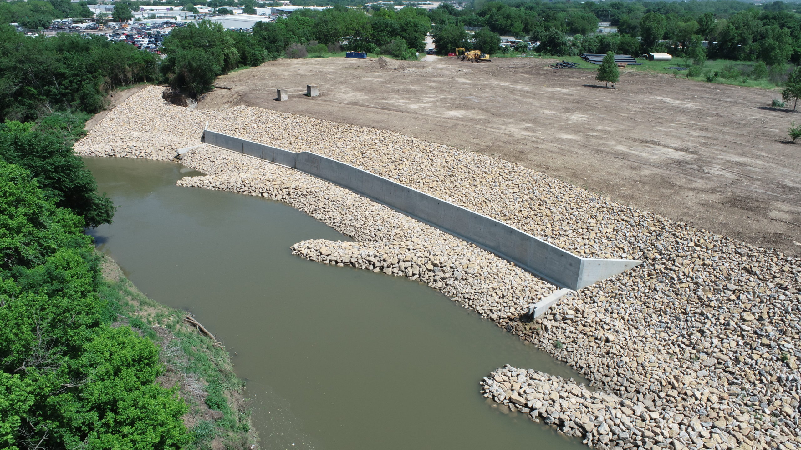
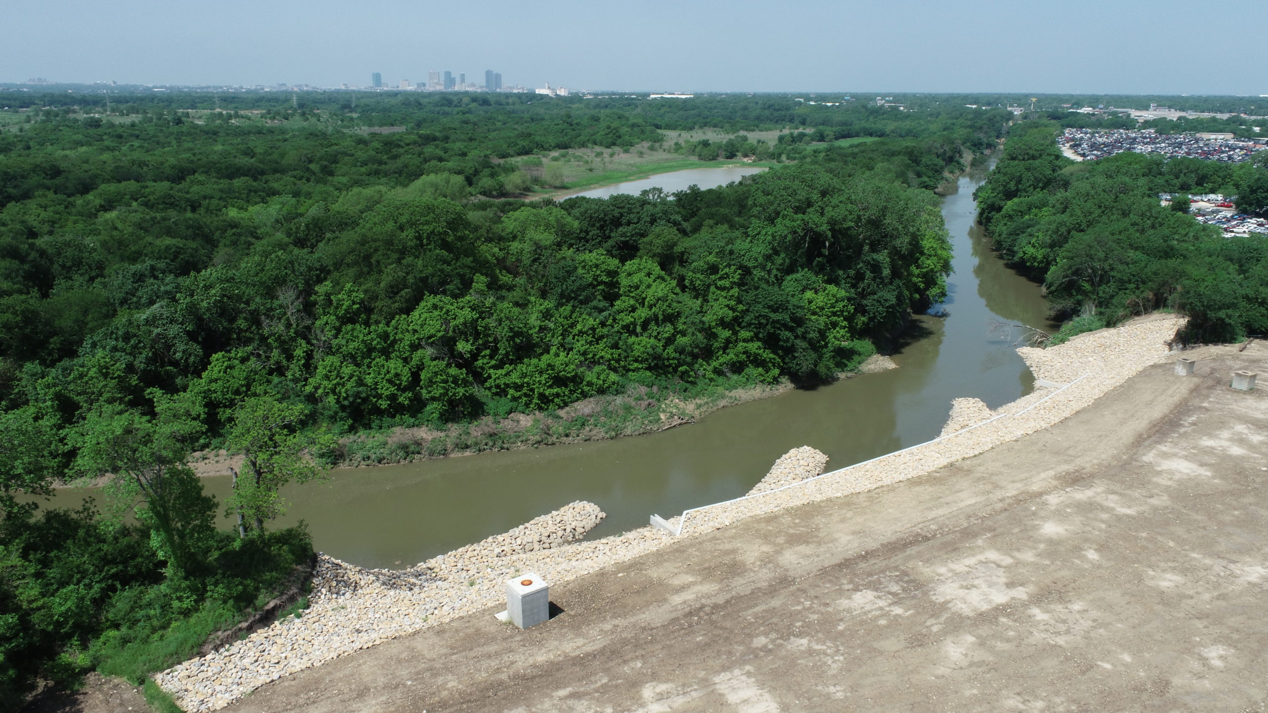
The repairs feature rock barbs, a launchable rock toe and a concrete terrace wall that stabilized the riverbank and protected the pipeline while saving the City on construction costs, reducing the potential environmental intrusion and benefitting the river’s aquatic health. This was the first time the U.S. Army Corps of Engineers Fort Worth District had permitted this Natural Channel Design technique.
Confronting Continuing Erosion
The crux of the problem was erosion perilously close to the City’s twin 90-inch-diameter sewer mains that parallel the Trinity River’s West Bank. The pipelines convey wastewater to the Water Reclamation Facility, which processes 166 million gallons of wastewater daily, serving more than 880,000 people and numerous industries in Fort Worth and 22 neighboring communities.
Record rains in 2015 set in motion erosion that exposed part of the wastewater main located closest to the river. After the damage was identified in 2016 following another rainy spring, the City’s initial repair effort was delayed during a federally required cultural resource investigation at the site. The delay created a scenario posing an array of complications to overcome:
- Repeated flooding eroded more of the pipelines’ cover and brought the river closer to the pipeline.
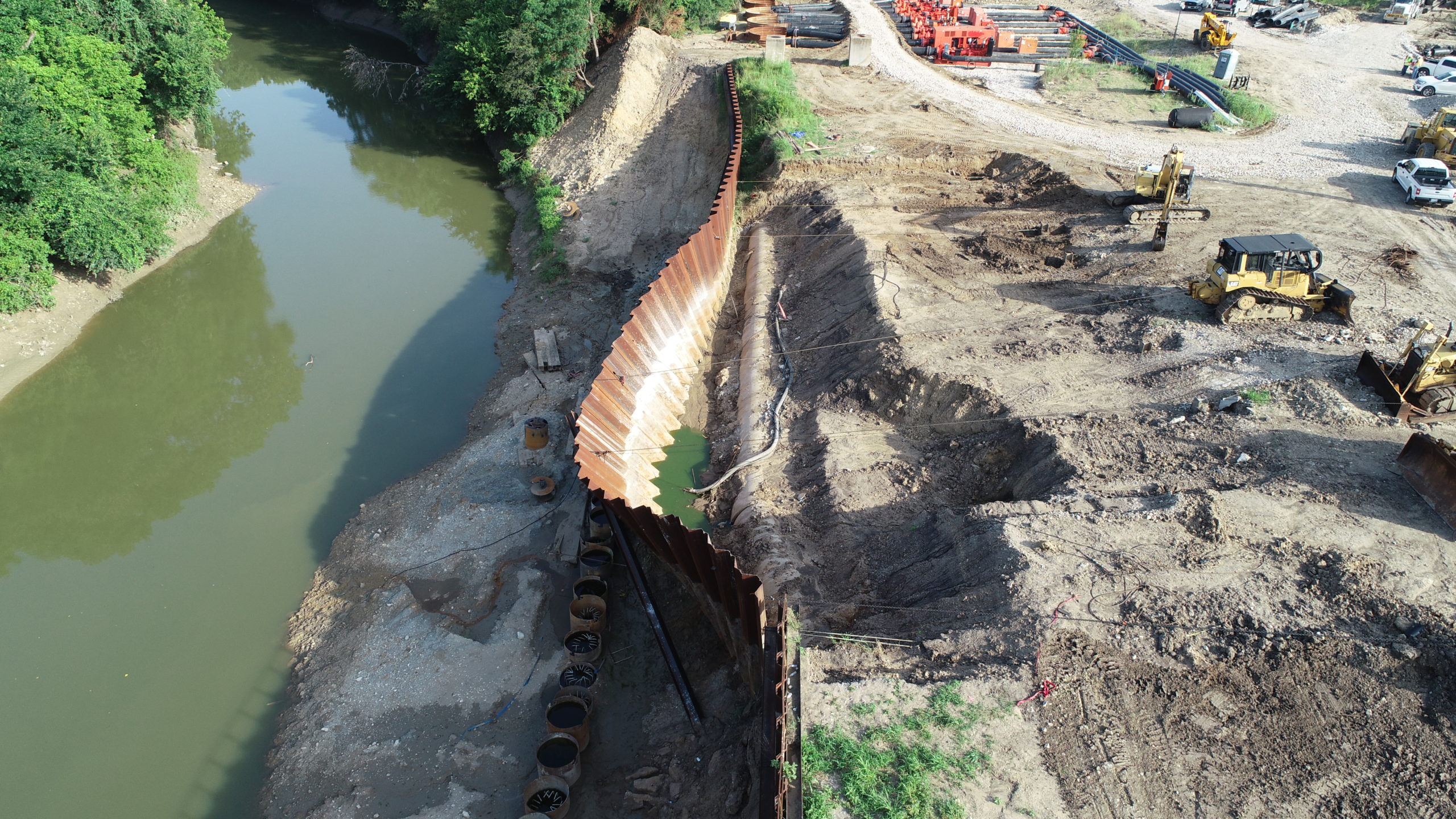
- A temporary solution failed when a sheet pile wall buckled.
- An emergency bypass of wastewater flow was needed to accommodate a pipe replacement.
- Ongoing erosion limited the pipeline repair area.
Though the City was ready to construct a permanent repair, more than 28 inches of rain soaked the region in September-October of 2018. The river’s swelling and receding water surface caused it to keep altering its course, exacerbating the erosion and leaving the original permanent repair design insufficient to solve the problem.
To temporarily reinforce the bank, a contractor worked with the City on a steel sheet pile wall. Meanwhile, the City hired Freese and Nichols in late 2019 to devise a new permanent repair. The new design used a series of Natural Channel Design flow deflection structures (rock barbs) to keep the deepest and fastest-moving water away from the edge of a strengthened streambank. This reduced the amount of material needed to protect against scour caused by the rushing water. The design also featured a launchable rock toe and a cast-in-place concrete wall for a stable grade and protection around the pipelines.
Resolving Another Crisis
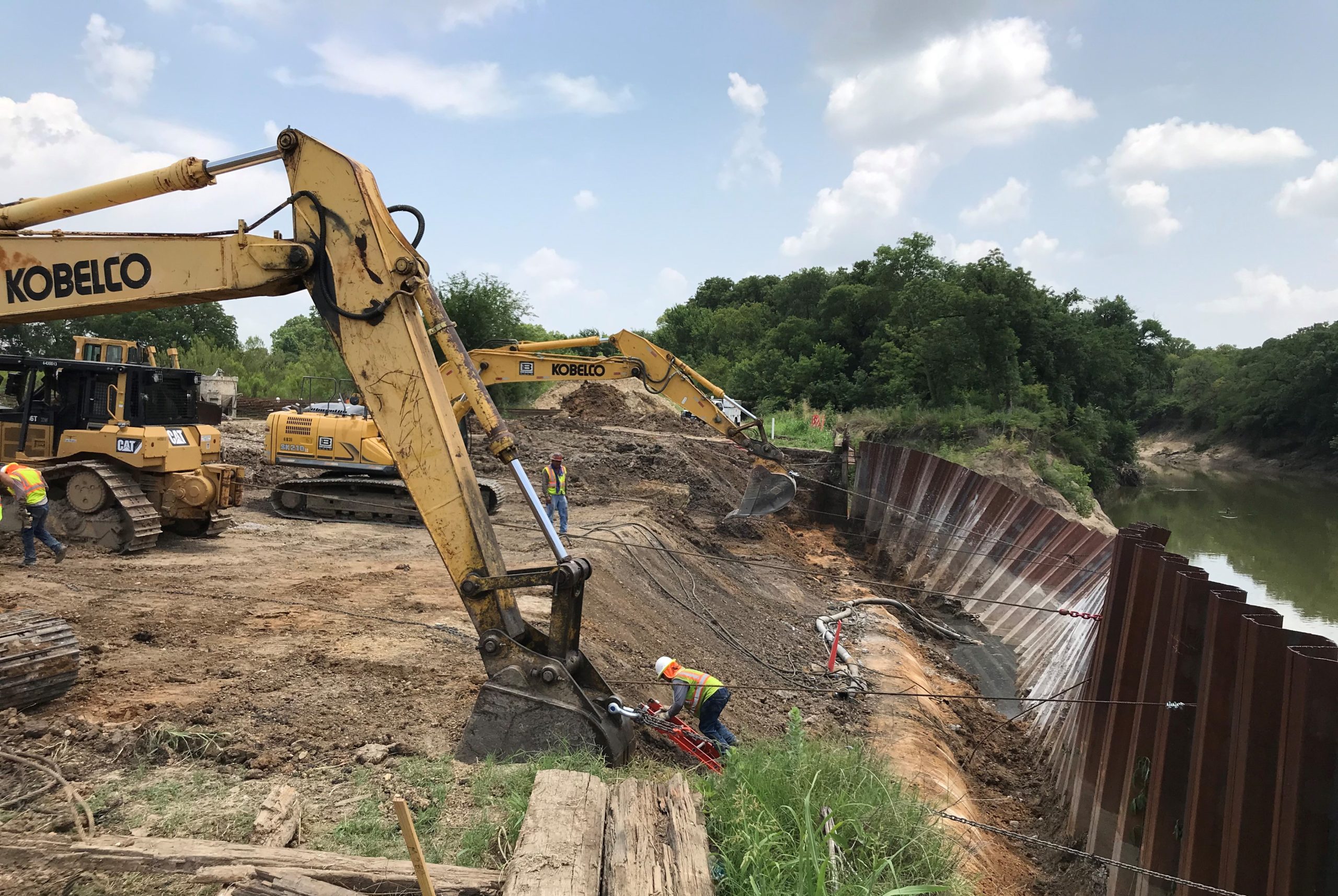
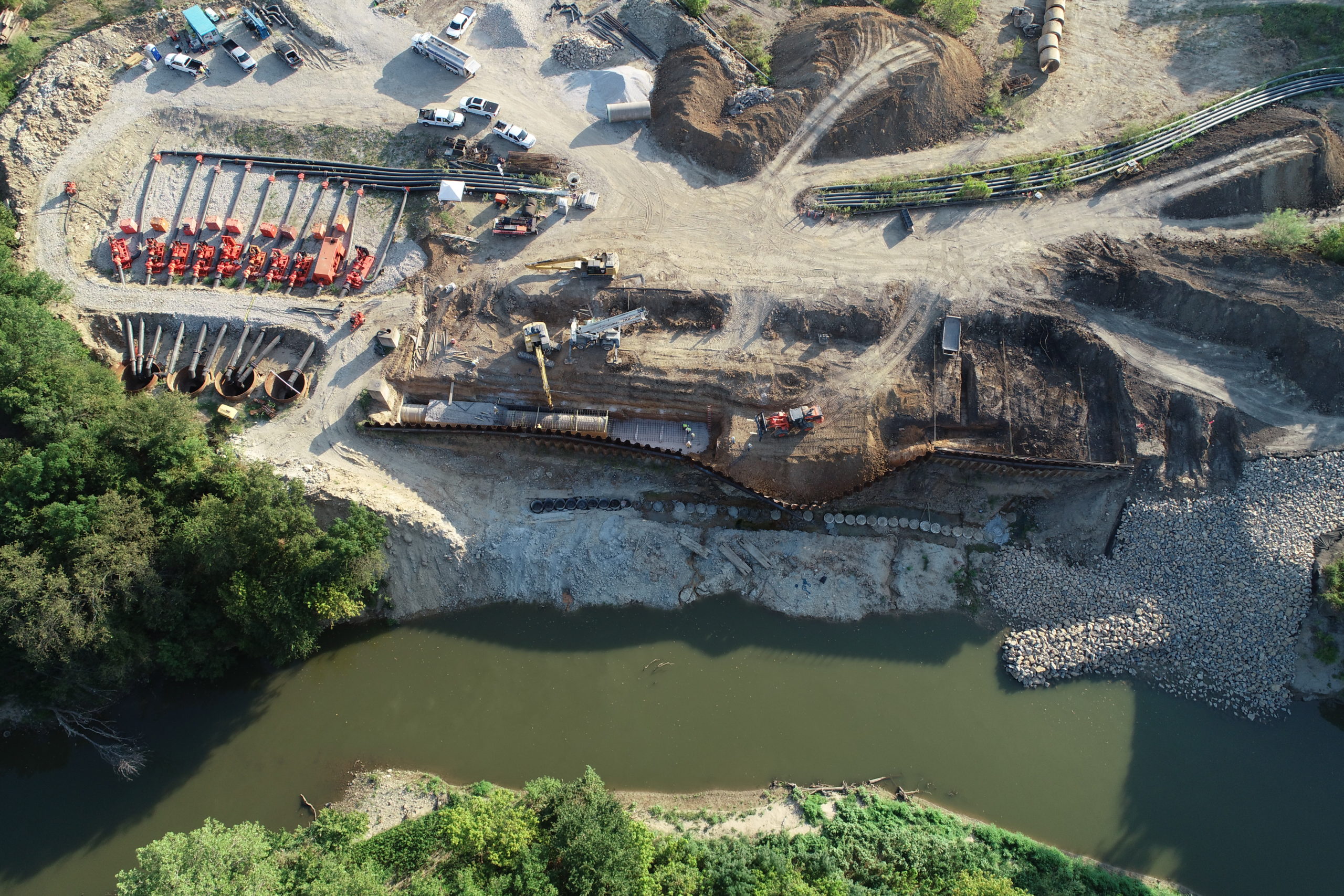
The urgency increased during construction. In summer 2020, with a quarter of the project completed, the temporary sheet pile wall failed. A 200-foot section of the sheet pile slumped from a 90-degree angle to a 30-45-degree angle, causing a segment of the riverward pipe to split.
Responding quickly with a team experienced in utility, structural, stormwater and geotechnical design, along with construction inspection personnel, Freese and Nichols developed a method for restoring the sheet pile wall by cutting a V-notch along its midsection, bending it back on itself and welding it in place.
A bypass system using 10 pumps capable of moving up to 150 MGD then diverted the wastewater flow from the damaged pipe to its landward twin while a 400-foot segment was removed and replaced. Once the sheet pile was stabilized and the pipe was repaired, the bank stabilization construction could resume.
Freese and Nichols committed more than a dozen highly experienced engineers, many of them Principals in the firm, to work on this project. The team prevented an environmental hazard and kept wastewater treatment services running without interruption — while improving conditions along the river for the long term.
Applying Innovative Resilience
The Trinity River has the distinction of having the largest basin whose watershed is entirely in the State of Texas. The West Fork, which runs through Fort Worth toward Dallas, feeds several lakes that provide drinking water for area residents. The river is an essential natural element for the region. A culturally sensitive site also was located proximally to the failed streambank.
As such, this entire project focused on environmental sensitivity, protection and sustainability. In essence, the goal was to prevent wastewater discharge into the river and to stabilize the river in a sensitive location. The project area’s fragility caused constraints — but allowed for a creative, nature-based, less-expensive solution than might otherwise have resulted. For instance, a tall wall to separate the pipes from the river couldn’t be built for lack of enough riverbank to anchor it. The designers started by using geomorphology to understand where the river might migrate over the next 50-100 years. That helped define where the protections should start and end.
The design revolved around three key elements:
- Rock barbs: These protrude upstream and divert the fastest part of the water flow away from the bank. Using this Natural Channel Design structure reduced the amount of excavation needed along the bank to guard against scour damage underneath the rock. The approach reduced the construction footprint on the river and saved the City on excavation costs. Pools that form around the bards also will provide attractive habitat for fish. This was the first time the U.S. Army Corps of Engineers Fort Worth District had permitted this technique.
- Launchable rock toe: When scour occurs, a hole is formed by the fast-moving water, removing native material on the river bed. The resulting hole undermines the rock riprap above, causing this material to roll into the hole. The launchable rock toe was designed to slump into the scour hole while protecting the shape of the uphill portion of strengthened streambank. This approach requires less excavation and materials than traditional scour protection measures.
- Concrete terrace wall: Because of the proximity of the wastewater lines to the river, there was not enough room for a stable slope, so a hybrid system was used, with a combination of a vertical reinforced concrete wall with slopes above and below the wall. A 430-foot cast-in-place concrete wall of varying heights was founded on a line tangent to drilled shafts. The wall was strategically located along the narrow strip of equipment-accessible land between the existing sheet pile wall and the river.
Two additional features are important to note:
- Willow stakes: Live saplings, though dormant when installed, were driven into gaps in the rocks. The trees eventually will sprout and grow, adding greenery and improved aquatic health along the bank. Their roots also will increase the cohesive strength of the bank, providing long-term stability.
- Flood rise: Because the area lies within a FEMA-delineated floodway, repairs could not increase the degree of rise along the river for a 100-year flood. By minimizing material needed, the design met this requirement.
